The MacLehose Trail is Hong Kong’s most celebrated long-distance path — 100 km that stride across the spine of the New Territories in ten numbered sections. And it begins, gloriously, in Sai Kung. Sections 1 and 2 deliver the trail’s signature scenery in a single sweep: a vast blue reservoir, world-class volcanic geology, and some of Hong Kong’s wildest, most beautiful beaches. If you only ever walk one part of the MacLehose, make it these two.
A trail with a history
The MacLehose Trail opened in 1979 and is named after Sir Murray MacLehose, the keen-walking governor who did much to create Hong Kong’s country parks in the 1970s. It was the territory’s first long-distance trail, and it remains the spine to which most other paths connect. Every year it hosts the famous Oxfam Trailwalker, in which teams of four attempt the entire 100 km — usually within 48 hours — to raise money for charity. You don’t need to be that heroic. The beauty of the trail’s sectioned design is that you can take it a piece at a time, and Sections 1 and 2 are where most people start, because this is where the scenery peaks.
The whole route here runs through Sai Kung East Country Park, a protected expanse of hills, coastline and reservoir that shelters the trail from development. There are no shops, no traffic and no buildings for long stretches — just water on one side, green peaks on the other, and the open South China Sea ahead.
Section 1: along the reservoir to the East Dam
Distance: ~10.6 km · Difficulty: easy–moderate (mostly flat) · Time: 3–4 hours
Section 1 begins at Pak Tam Chung, the main gateway and visitor hub for the eastern country park. There’s a visitor centre here, the start of the gentle Pak Tam Chung Nature Trail, and the historic Sheung Yiu folk village nearby — worth a look before you set off.
From Pak Tam Chung the trail follows a wide, paved service road that traces the southern shore of the High Island Reservoir. This is some of the easiest walking on the entire MacLehose: smooth surface, gentle gradients, and sweeping views across the water the whole way. The reservoir itself is a feat of engineering — built in the 1970s by damming a sea channel at both ends, turning a strait into a freshwater lake.
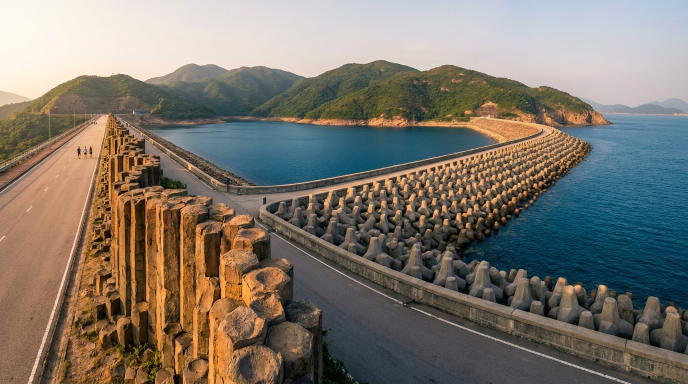
The section’s grand finale is the East Dam, where the geology becomes spectacular. Here you can stand right beside the rhyolitic hexagonal volcanic columns that formed roughly 140 million years ago and that earned the area its status as part of the Hong Kong UNESCO Global Geopark. There’s also a dramatic sea cave, a sea arch and a blowhole carved by the waves, plus the curious “dolosse” — giant interlocking concrete blocks that armour the dam against typhoon swells. Because Section 1 is flat and well-surfaced, it suits families, first-time hikers and anyone who simply wants the geology without the climbing.
Section 2: over the hills to Tai Long Wan
Distance: ~13.5 km · Difficulty: moderate–hard (climbs + exposure) · Time: 4–6 hours
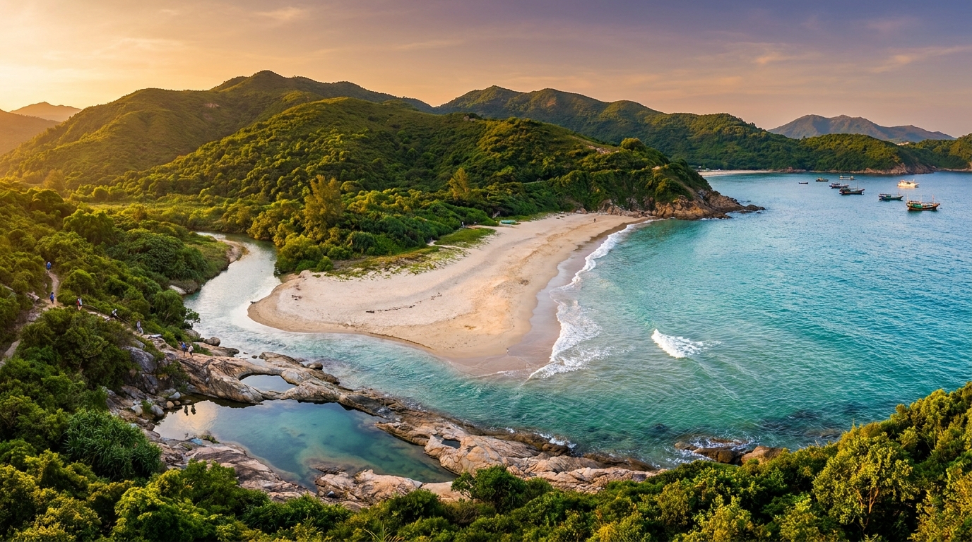
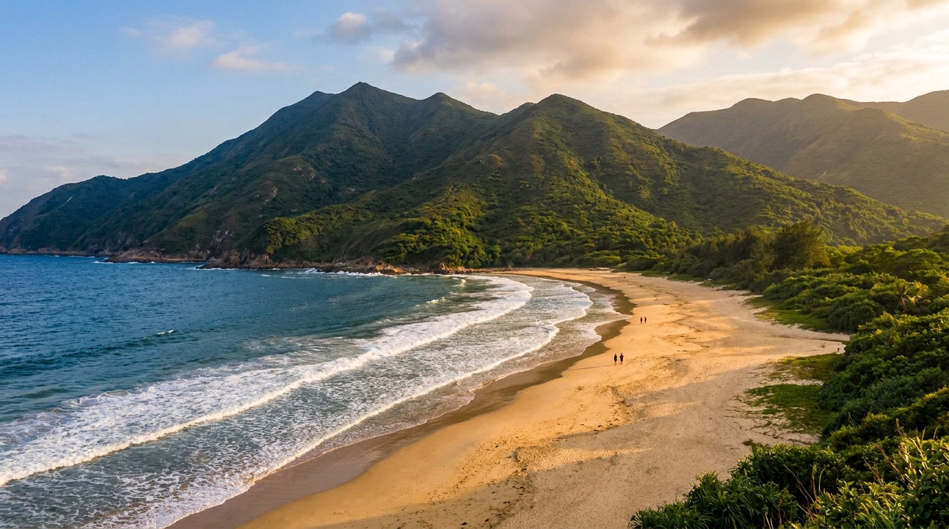
Section 2 is a different animal. From the East Dam the trail turns inland and climbs steeply over a shoulder of hills before swinging back toward the coast and descending to the celebrated beaches of Tai Long Wan (Big Wave Bay) — Sai Wan, Ham Tin and Tai Wan in turn. This is proper hill-walking: there are real ascents, uneven ground, exposed ridgelines and very little shade. On a hot, humid day it can be genuinely demanding, so pace yourself and carry more water than you think you need.
The payoff, though, is extraordinary. You crest a rise and the whole sweep of golden, surf-washed bays opens beneath you — a view regularly voted among the finest in Hong Kong. Many walkers choose to descend to Sai Wan for a swim and a rest at the village stores, then exit by boat rather than push on. Those who continue follow the coast past Ham Tin’s wooden footbridge and on toward Chek Keng, where the trail eventually meets transport at Wong Shek.
For the very fit, the conical peak of Sharp Peak rises just north of the beaches — a strenuous, unofficial scramble that rewards with a panorama over the whole bay. It is not part of the official MacLehose and should only be attempted by experienced, well-equipped hikers in good weather.
Planning your hike
| Section 1 | Section 2 | |
|---|---|---|
| Distance | ~10.6 km | ~13.5 km |
| Time | 3–4 hrs | 4–6 hrs |
| Terrain | Flat paved road | Hilly trail, beaches |
| Difficulty | Easy–moderate | Moderate–hard |
| Highlight | East Dam columns | Tai Long Wan beaches |
| Exit | Road at East Dam | Boat from Sai Wan / Wong Shek |
Getting to the start. First reach Sai Kung Town (see the transport guide — there is no MTR station in Sai Kung, so most visitors come via Diamond Hill or Choi Hung MTR). From the town, take bus 94 toward Wong Shek and alight at Pak Tam Chung; on Sundays and public holidays the 96R runs from Diamond Hill direct. A taxi to the trailhead is also an easy option for a group.
Water and food. Carry plenty of water — at least two litres in summer. There are seasonal drinks stalls and small village stores at Sai Wan and Ham Tin selling cold drinks, instant noodles and the odd beer, but they keep irregular hours and you must not rely on them. Pack snacks, sun protection and a hat.
Exit options. The single best trick for tired legs is the speedboat or kaito from Sai Wan back to Sai Kung Town (weather permitting). It turns a brutal return slog into a 20-minute sea cruise, and on busy weekends boatmen wait at the beach. Confirm the price and the last departure before you commit.
Best time and safety
The ideal seasons are autumn (October–December) and spring, when the air is cooler and drier. Avoid hot summer afternoons — heatstroke is the most common hiking incident in Hong Kong — and always check the weather first. Never start if a rainstorm (amber/red/black) or typhoon signal is hoisted: the streams flash-flood, the rocks turn lethally slippery, and the Tai Long Wan boats stop running.
A few rules keep this hike safe and enjoyable:
- Start early. Section 2 takes longer than people expect; you do not want to be on the hills at dusk.
- The beaches are unpatrolled. Tai Long Wan has rip currents and real surf with no lifeguards — swim close to shore, never alone, and respect the sea.
- Tell someone your plan and carry a charged phone; signal is patchy but works on the high ground.
- Take all litter home. These are pristine, protected places — leave no trace.
Pair the walk with the East Dam geology at the start and a well-earned Sai Kung Town seafood dinner at the end, and you have one of the great days out anywhere in Hong Kong.
Frequently asked questions
How long are Sections 1 and 2 of the MacLehose Trail?
Section 1 is about 10.6 km (mostly flat, along the reservoir) and Section 2 is about 13.5 km (hillier, with beach access). Together they make a long but rewarding day; many hikers split them or exit at Sai Wan.
Where do the sections start and end?
Section 1 starts at Pak Tam Chung and ends at the High Island Reservoir East Dam. Section 2 continues from the East Dam over the hills to Tai Long Wan and on to Ham Tin and Chek Keng.
How do I get to the start at Pak Tam Chung?
Take bus 94 or, on Sundays/holidays, bus 96R toward Wong Shek, alighting at Pak Tam Chung. From the city, first reach Sai Kung Town — see the transport guide.